Revealing High-Impact Locations for Maritime Methanol Adoption
As the maritime industry decarbonizes, shipping companies must decide which alternative fuels will power the future of global shipping. But where is low-carbon methanol best positioned to succeed?
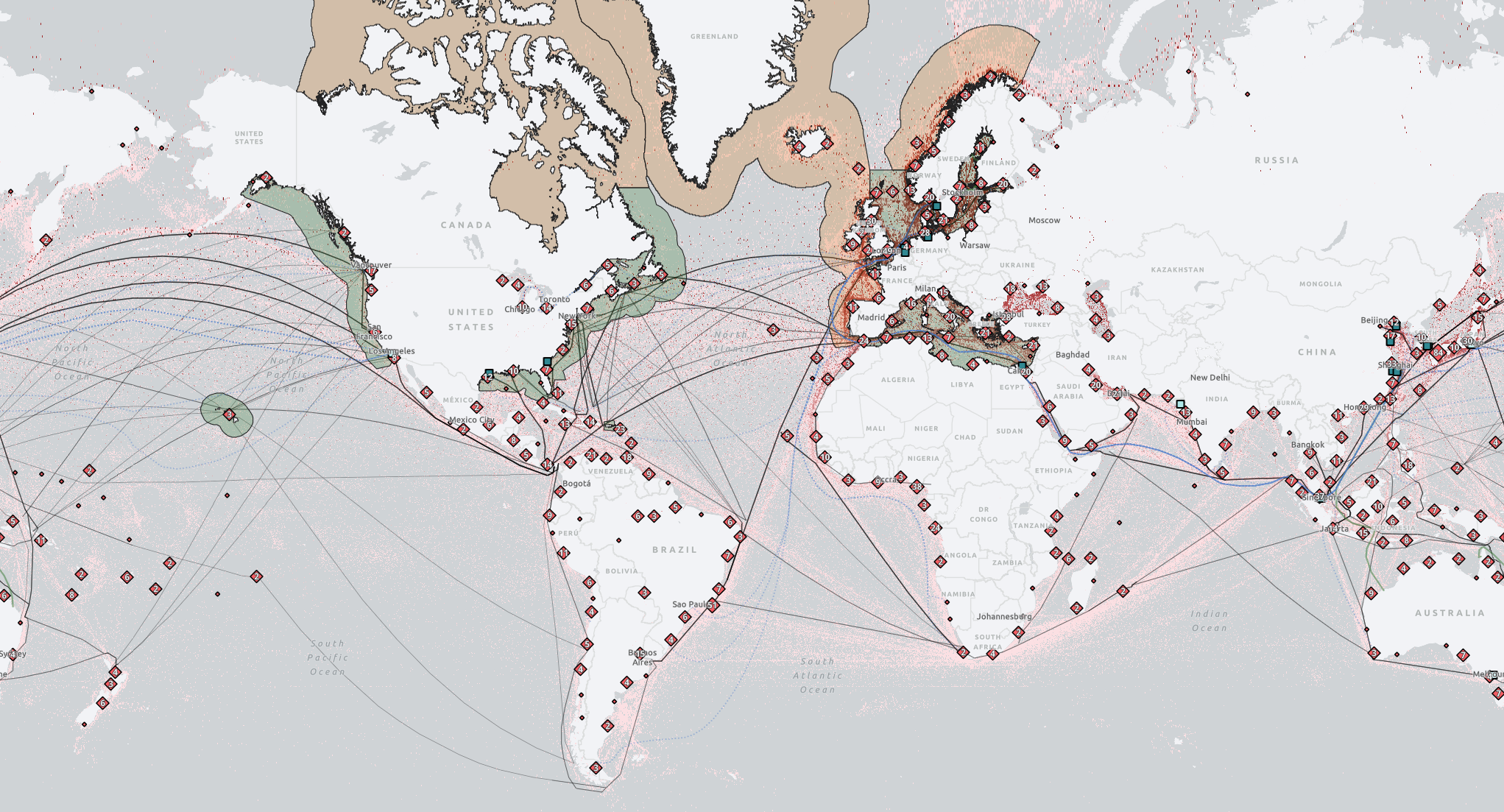
The Methanol Opportunity Map (MOM) identifies ports and regions with the strongest potential for methanol adoption by highlighting where bunkering infrastructure, maritime policy and initiatives, and shipping activity align.
Explore the map below to discover where the transition is already underway. To see an example of MOM in action, check out our “Opportunities for Methanol Adoption” StoryMap. Using Singapore as a case study, our StoryMap demonstrates how the MOM can identify high-potential regions for methanol adoption and provide deeper insights into the factors driving those opportunities.
Click here to view the MOM in ArcGIS Experience Builder.
For any questions or concerns, please contact us at nicole.gotthardt@cclab.org
Attribution details and the link to the GitHub repository, which includes backend datasets, can be found below.
The table below provides a more detailed overview of relevant maritime policies and regulations included in "Policy Instruments" under Layer 2.
Data Attribution & Licensing
© Carbon Containment. The backend datasets underlying the Methanol Opportunity Map (MOM) are licensed under the Creative Commons Attribution 4.0 International (CC BY 4.0). You are free to share and adapt these data provided appropriate attribution is given. View the license deed here.
The interactive web map interface, basemap, and mapping services are provided by Esri and are not covered by the CC BY 4.0 license. These components remain subject to Esri's terms of use and applicable intellectual property rights.
GitHub
Click here to access and download the backend datasets underlying the Methanol Opportunity Map (MOM) on GitHub.